
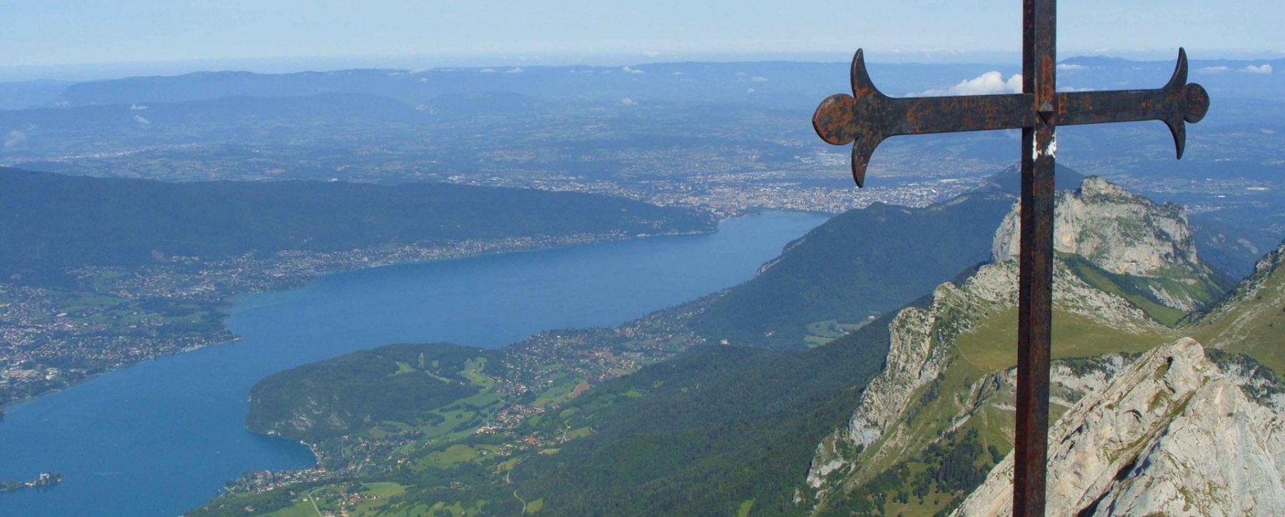
The mountains around Annecy, the Venice of the Alps, are dotted with hiking trails that are a walker’s delight. One of the most popular routes to take during your camping vacation in Annecy is the one leading to La Tournette, a peak in the Bornes massif which rises to 2,351 m above sea level. Its fame is due in part to its massive appearance and 360º panoramic views of the Alps and Lake Annecy.
Practical information for climbing the Tournette summit
There are several possible departures for this hike. The longest and most demanding routes are those starting from Lake Annecy and the Dents de Lanfon.
To make the hike accessible to as many hikers as possible, we have selected the route that starts at the Chalet de l’Aulp, above the Col de la Forclaz. Park your car in the chalet restaurant parking lot, fasten your shoelaces, adjust your poles and glasses, get out your sun protection and take stock of your rucksack: it’s time for the ascent.
Important: On the final section, you’ll have to climb some slippery walls and slopes. Despite the presence of bars and chains to help you negotiate them, this hike should be avoided in wet weather.
- Level: Difficult
- Duration: 4h00 round trip
- Start: Chalet de l’Aulp, 1,424 m
- Finish: Tournette summit, 2,351 m
- Difference in altitude: 927 m
- Loop circuit: no
Hike from Chalet de l’Aulp to Refuge de la Tournette
You’ll start walking under the watchful eye of the cows and, without a round of observation, your calves and quadriceps will be put to the test. Above all, make sure you manage your efforts well: the mountains demand respect, and the summits you think you can touch are always further away than you think. Altitude also plays its part, and you may run out of air on the final stretch if you burn out too quickly. Follow the winding path and, after 45 minutes to an hour’s climb, you’ll reach a small plateau near the former chalet du Casset. You’ll spot some ewes, who like to take refuge in the shade of the boulders on fine days. At the edge of the cliff, you can make out the refuge de la Tournette. Congratulations, you’ve just completed the first part of the ascent. Celebrate your achievement by admiring the landscape and imagining the views that await you at the summit.
Hike from the refuge to the summit of La Tournette
Cross the plateau to the left, walking along the scree. Above all, don’t stay at the foot of the cliff. Cross the small streams created by melting snow, continue upwards and rejoin the dirt track. You’ll find that the path gets rougher and rougher. After an hour’s climb from the refuge, you’ll reach another small plateau where you can stop for a rest. Below, you’ll see Lake Annecy and its capricious contours. The Pierre Châtelard will also surprise you with its astonishing shape. Then it’s on to the hardest part. Use the chains and bars to climb the walls. Even casual hikers (seniors and children do this hike) will find it easy. Follow the path along the edge of the cliff. There’s a good chance you’ll be greeted by the local hosts, the ibex. Photograph them, take a breather and admire the massif des Bornes, the Aravis range and the Pic de Jallouvre. See that large boulder on your right? It’s nicknamed the Fauteuil. The ibex may be willing to lend it to you for a few minutes (access from the left) if they go for a walk on the ridges. You’re almost there! Grab the wire rope, climb the two ladders and you’ll finally reach the highest point. From now on, all words are useless. The views and sensations belong to each individual. If the sky is clear, Mont Blanc will appear in your postcard landscape, with a panoramic lake view. If you’re the farsighted type, you’ll take your windbreaker out of your rucksack and your poles for the descent.
There’s lots more to do in the region, including trekking in the mountain pastures, snowshoeing and ski touring in the ski areas around Chamonix and Le Grand Bornand, or on the slopes of the glacier for the more adventurous. For a change of scene, mountain biking and paragliding are also common in Haute Savoie!